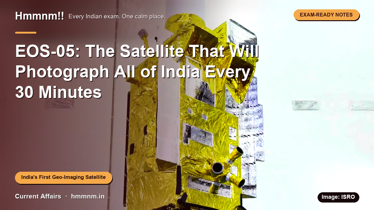
In one line: On 4 September 2026, ISRO launched EOS-05 (GISAT-1A) — India's first dedicated imaging satellite to watch the country continuously from 36,000 km away, five years after the satellite it replaces was lost to a rocket failure.
Compiled 6 September 2026 · Current Affairs · 12 min read
- Why put a camera 36,000 km away?
- A quick physics refresher: what “geosynchronous” actually means
- The launch in numbers
- The rocket in plain terms
- How the climb to orbit works
- What the camera can see
- Why hyperspectral matters
- What India will use it for
- Where EOS-05 fits in India’s watch fleet
- The part that makes this story human: 2021
- Why the failures were collectively significant
- Fact-check box: what’s true, what’s muddled
- Exam angles: where this shows up
- Revision card
- FAQs
- Is EOS-05 and GISAT-1A the same satellite?
- Why does EOS-05 matter for disaster management?
- How is EOS-05 different from INSAT-3DS?
- Was the GSLV-F17 launch successful?
- What resolution does EOS-05 offer?
- How long until EOS-05 starts delivering images?
Cover image: GSLV-F17 lift-off — Source: ISRO (isro.gov.in)
In one line: On 4 September 2026, ISRO launched EOS-05 (GISAT-1A) — India’s first dedicated imaging satellite to watch the country continuously from 36,000 km away, five years after the satellite it replaces was lost to a rocket failure.
It was raining at Sriharikota that morning. Nobody moved the launch.
At 2:55 AM on 4 September 2026, ISRO’s GSLV-F17 rose off the second launch pad through pre-dawn drizzle, carrying a 2,367 kg satellite called EOS-05. Eighteen minutes later the satellite was in orbit, and ISRO had its first successful launch of the year.
That bare sentence undersells what happened. This satellite is a strange and rather clever idea — and it closes a wound that has been open since 2021.
Why put a camera 36,000 km away?
Here’s the thing about most Earth-observation satellites. They circle the planet a few hundred kilometres up. That gives you lovely sharp pictures — but of the same spot, only once every few days. For a farmer’s crop estimate, that’s fine. For a cyclone spinning up in the Bay of Bengal, it’s useless. The storm doesn’t wait for your satellite to come back around.
So ISRO did the opposite of the obvious. EOS-05 goes out, not down. Its final home is geosynchronous orbit, about 36,000 km up — the height where a satellite’s orbital period exactly matches Earth’s rotation, so it hangs over the same patch of the planet non-stop.
Think of it as the difference between a photo booth and a CCTV camera. Every Indian remote-sensing satellite so far was a photo booth: sit still, wait for the click. EOS-05 is the CCTV: always on, always watching, always recording.
The trade-off is resolution. From that height, 42 metres is the best it can manage in its sharpest mode — a polar satellite can see far finer detail. But for clouds, floods and fires, you need frequency more than sharpness. You need to know what changed in the last half hour.
And that’s the number worth remembering: EOS-05 can image any chosen region of India every 5 minutes, and the entire Indian landmass every 30 minutes. No Indian satellite has ever done that.
A quick physics refresher: what “geosynchronous” actually means
It’s worth pausing on the term, because exams love it. An object in geosynchronous orbit takes exactly 23 hours, 56 minutes and 4 seconds — one sidereal day — to complete one lap of Earth. If that orbit is also almost perfectly circular and tilted at 0° to the equator, it’s called geostationary: the satellite appears motionless in the sky. In practice, EOS-05 will hover near a fixed longitude (about 93.5° East) with only small drift, which ground stations correct with occasional thruster burns. The crucial consequence for imaging is this: the satellite never loses sight of its target, and there is no waiting for a pass overhead. Data can flow continuously, hour after hour, day after day — which is precisely what tracking a fast-changing event demands.
The launch in numbers
| Item | Detail |
|---|---|
| Satellite | EOS-05, also called GISAT-1A |
| Rocket | GSLV-F17 — the 19th flight of the GSLV |
| When | 4 September 2026, 2:55 AM IST |
| Where | Second Launch Pad, Satish Dhawan Space Centre, Sriharikota |
| Satellite mass | 2,367 kg — the heaviest payload a GSLV has ever carried |
| Orbit delivered | Sub-GTO (roughly 171 × 31,026 km), tilted 19.28° |
| Final posting | ~36,000 km, around 93.5° East longitude |
| Design life | 7 years assured; ISRO’s chairman expects 9 or more |
The rocket actually performed slightly better than planned. That’s a quiet bonus. EOS-05 now needs less of its own fuel to climb to its final slot, and leftover fuel stretches its working life. It also means the satellite can afford more station-keeping over the years — the small burns that hold it exactly on station against the tug of the Moon, the Sun and Earth’s uneven gravity.
The rocket in plain terms
The GSLV — Geosynchronous Satellite Launch Vehicle — is India’s three-stage workhorse for sending heavy satellites towards geosynchronous orbit. It stands about 51.7 metres tall, stacking solid, liquid and cryogenic stages, and it is that cryogenic top stage which makes or breaks a flight. It broke GISAT-1’s ride in 2021. The fixes ISRO made afterwards were validated on the NISAR Earth-observation mission flown with NASA in 2025, and GSLV-F17 — the vehicle’s 19th flight — carried them to a clean result, lifting the heaviest payload a GSLV has ever been trusted with.
How the climb to orbit works
GSLV-F17’s journey had three acts. First, the liquid-fuelled core stage and four liquid strap-on boosters pushed the vehicle off the pad and through the thickest part of the atmosphere. Second, the solid-fuelled second stage took over, adding speed. Finally, the cryogenic upper stage — burning liquid hydrogen and liquid oxygen at temperatures near absolute zero — delivered the satellite into Sub-GTO, a stretched elliptical orbit reaching about 31,026 km at its highest point. Because the rocket overshot its targets slightly, the orbit was better than planned. From there, EOS-05’s own propulsion takes over, raising the orbit’s lowest point and trimming the tilt over days and weeks until the satellite settles into its circular slot at 36,000 km. That slow climb is why a “successful launch” and an “operational satellite” are separated by weeks of careful orbit-raising and testing.
What the camera can see
EOS-05’s 700 mm telescope is a design ISRO first flew on Cartosat-2A. It feeds three sets of detectors:
| Mode | Channels | Resolution | What it’s for |
|---|---|---|---|
| Multispectral (VNIR) | 6 | 42 m | Everyday imaging — land, water, clouds |
| Hyperspectral (VNIR) | 158 | 318 m | Crop type, vegetation health |
| Hyperspectral (SWIR) | 256 | 191 m | Moisture, fire hotspots, minerals |
In plain terms: it sees in ordinary colour, in fine slices of colour humans can’t see, and in heat-adjacent infrared. Union Minister Jitendra Singh highlighted exactly this range — visible, infrared, multispectral, hyperspectral — after the launch.
Why hyperspectral matters
A normal camera records three broad bands of light: red, green, blue. A hyperspectral sensor records dozens to hundreds of narrow slices of the spectrum, and each slice carries a fingerprint. Healthy crops reflect sunlight in a subtly different pattern than water-stressed ones; turbid floodwater reads differently from clean river water; certain minerals announce themselves in the short-wave infrared. With 158 channels in the visible-and-near-infrared range and 256 in the short-wave infrared, EOS-05 can distinguish these fingerprints from orbit — repeatedly, over the same territory, on a schedule no other Indian asset matches. For agricultural scientists, that means crop-type mapping and stress detection can happen weekly rather than seasonally. For disaster managers, the SWIR channels are particularly valuable at night and through smoke, when visible-light cameras are effectively blind.
What India will use it for
- Disasters first. Cyclones, floods, cloudbursts, forest fires. A picture every five minutes turns rescue planning from guesswork into monitoring. Forecasters can watch a cyclone’s eye wall tighten, measure the speed of movement directly from successive frames, and see which districts the flood front has reached — in near real time.
- Agriculture. Frequent, nationwide crop assessment — useful for food-price planning as much as for farmers. Sowing-area estimates, drought early warning and yield forecasting all improve when the same ground is revisited every half hour rather than every fortnight.
- Continuous observation. A permanent watch over the subcontinent. ISRO Chairman V. Narayanan was asked whether this makes it a spy satellite; he dismissed the idea outright. At 42 m resolution, the satellite simply cannot pick out vehicles, buildings or people — its targets are storms, rivers, fields and fires.
- Weather and climate research. Continuous, channel-rich imagery feeds directly into monsoon studies, land-surface temperature tracking and long-term climate records.
Where EOS-05 fits in India’s watch fleet
India already runs a large fleet of imaging satellites in low Earth orbit — the Cartosat, Resourcesat and RISAT series among them — which deliver fine detail, but only every few days per location. Higher up, the INSAT-3D, 3DR and 3DS weather satellites have hung for years with simpler imagers tuned for clouds.
EOS-05 slots neatly between the two: coarser pictures than the LEO fleet, but far richer and far faster than the weather satellites. Together they now cover both ends of the trade-off — detail when you can afford to wait, frequency when you can’t. A planned GISAT-2 would extend this geostationary watch further.
A useful analogy for the fleet: think of Cartosat and RISAT as the photographers who travel to the scene and capture the close-up, and EOS-05 as the newsroom that watches the whole story unfold live and directs the photographers where to go. In a real cyclone response, EOS-05 spots the district taking the worst of the landfall within minutes, and a low Earth orbit satellite or a drone can then be tasked to image that specific area in fine detail.
The part that makes this story human: 2021
GISAT-1, the satellite EOS-05 replaces, was jinxed from the start. Its launch slid repeatedly through 2020 and 2021 — a technical issue, then the COVID lockdown, then a voltage problem. When it finally flew on 12 August 2021 aboard GSLV-F10, the cryogenic upper stage failed. The onboard computer aborted the flight about five minutes in. The satellite ended up in the sea.
The replacement didn’t have an easy run either. Slips through 2026 over hardware issues on the rocket pushed it from its earlier targets to this September window. So when GSLV-F17’s engines lit on the 4th, it carried a bit more than a satellite — it carried a five-year-old IOU.
Then there’s the wider backdrop. ISRO’s PSLV had failed twice in a row before this — in May 2025 and again on 12 January 2026, when PSLV-C62 lost 16 satellites. EOS-05 was ISRO’s first flight since. After the launch, Narayanan confirmed the satellite’s health. He also announced six more launches this financial year, alongside continuing Gaganyaan work.
Why the failures were collectively significant
Space agencies around the world measure themselves not by whether launches ever fail, but by how they respond when they do. ISRO’s pattern here follows a well-established template: a failure review board identifies the root cause, hardware and software fixes are designed and tested on the ground, the fixes are validated on an actual flight — in this case NISAR with NASA in 2025 — and only then is a high-value national mission flown on the corrected vehicle. That sequence, spread across five years, is precisely why the GISAT replacement could finally fly with confidence. For exam purposes, this arc is the story: failure, investigation, validation, success.
Fact-check box: what’s true, what’s muddled
We verified every claim above against ISRO’s official mission page and brochure, plus coverage in Livemint, The Hindu and India Today. Three things are commonly mixed up online:
- EOS-05 is not INSAT-3DS. INSAT-3DS is a weather satellite that flew on GSLV-F14 back in February 2024. Some posts mislabel it EOS-05. Official EOS-05 is GISAT-1A, launched September 2026.
- “First imaging satellite from geosynchronous orbit” needs the word “dedicated”. India’s INSAT-3D/3DR/3DS weather satellites sit in GEO and carry simple imagers. EOS-05 is the first dedicated high-resolution Earth-observation satellite up there. The careful wording is “first dedicated geo-imaging satellite”.
- The 4 September date is correct. A cached ISRO page and some coverage mention earlier 2026 dates — those were the postponed windows before hardware issues were sorted. The actual lift-off was 4 September 2026, 2:55 AM IST.
Exam angles: where this shows up
Prelims: the names and numbers — EOS-05 = GISAT-1A, GSLV-F17 (19th GSLV flight), geosynchronous orbit (~36,000 km), the 5-minute/30-minute cadence, 42 m resolution, Sub-GTO of roughly 171 × 31,026 km at 19.28°. And the people: Chairman V. Narayanan, Mission Director Thomas Kurien. Watch for match-the-following questions pairing satellites with their orbits (INSAT-3DS — geostationary, weather; Cartosat — LEO, high resolution; EOS-05 — geostationary, dedicated geo-imaging).
Mains GS-III (Science & Technology / Disaster Management): “Near-real-time satellite imaging changes the economics of disaster response in India. Discuss.” Argue both sides. Frequency helps cyclone and flood response a great deal — evacuation windows widen, resource pre-positioning improves, and damage mapping speeds up. But 42 m resolution limits street-level damage assessment, so LEO satellites and drones stay essential. That GEO-plus-LEO mix is the honest answer, and questions on cooperative federalism can note that state disaster authorities are often the ultimate users of this central capability.
Interview: the failure-to-success arc (GSLV-F10 2021 → EOS-05 2026) is a ready example of how ISRO handles setbacks — investigation, hardware fixes validated on NISAR in 2025, then this flight. It also illustrates India’s growing space self-reliance, a theme interview boards frequently probe.
Revision card
- EOS-05 = GISAT-1A · GSLV-F17 (19th GSLV flight) · 4 Sept 2026, 2:55 AM IST · Sriharikota SLP
- India’s first dedicated imaging satellite in geosynchronous orbit (~36,000 km, slot ~93.5°E)
- 2,367 kg — heaviest satellite ever on a GSLV · life 7 years
- Any region every 5 min; all of India every 30 min; best resolution 42 m
- Camera: 700 mm telescope (Cartosat-2A heritage) · 6 MS + 158 hyperspectral VNIR + 256 hyperspectral SWIR channels
- Uses: cyclones, floods, forest fires, cloudbursts, agriculture
- Replaces GISAT-1 (EOS-03), lost on GSLV-F10, 12 Aug 2021
- First ISRO launch success of 2026, after PSLV-C61 (May 2025) and PSLV-C62 (Jan 2026) failures
- Chairman V. Narayanan · Mission Director Thomas Kurien · 6 more launches this FY
FAQs
Is EOS-05 and GISAT-1A the same satellite?
Yes. EOS-05 is the operational name in ISRO’s Earth-observation series; GISAT-1A is the series name. It is the second GISAT satellite, after GISAT-1 (EOS-03) was lost in 2021.
Why does EOS-05 matter for disaster management?
It can re-image any selected region every 5 minutes from geosynchronous orbit. So agencies tracking a cyclone or flood get near-live updates, not pictures that are hours or days old. That speed matters most in the first hours of an event, when evacuation and rescue decisions are being made.
How is EOS-05 different from INSAT-3DS?
INSAT-3DS (launched February 2024 on GSLV-F14) is a meteorological satellite with weather imagers. EOS-05 is a dedicated Earth-observation satellite with multispectral and hyperspectral cameras at higher imaging cadence. In short: INSAT-3DS watches the atmosphere; EOS-05 watches the land, water and atmosphere together, in far more spectral detail.
Was the GSLV-F17 launch successful?
Yes. ISRO confirmed precise injection into the intended Sub-GTO about 18 minutes after lift-off. The satellite is healthy, its solar panels are deployed, and it is now climbing to the operational slot.
What resolution does EOS-05 offer?
42 metres in multispectral (VNIR) mode, 318 metres in hyperspectral VNIR, and 191 metres in hyperspectral SWIR — from roughly 36,000 km away. Each pixel in the sharpest mode covers an area of about 42 × 42 metres on the ground — enough to see a village, a flooded field or a forest fire front, but not individual buildings.
How long until EOS-05 starts delivering images?
The satellite must first raise itself from Sub-GTO to its circular geosynchronous slot — a process of repeated thruster burns over several weeks — followed by payload commissioning and calibration. Routine imaging services typically begin once in-orbit tests are complete and results are validated against ground data.
Read next: more current affairs · Science & Technology explainers · exam notifications calendar
Sources: ISRO GSLV-F17/EOS-05 mission page · Wikipedia — EOS-05 · Livemint · The Hindu · India Today · ISRO mission brochure (PDF) · Featured image: Source: ISRO. Compiled 6 September 2026.
Quick revision
- Disasters first.: Cyclones, floods, cloudbursts, forest fires.
- Agriculture.: Frequent, nationwide crop assessment — useful for food-price planning as much as for farmers.
- Continuous observation.: A permanent watch over the subcontinent.
- Weather and climate research.: Continuous, channel-rich imagery feeds directly into monsoon studies, land-surface temperature tracking and long-term climate records.
- EOS-05 is not INSAT-3DS.: INSAT-3DS is a weather satellite that flew on GSLV-F14 back in February 2024.
- India’s INSAT-3D/3DR/3DS weather satellites sit in GEO and carry simple imagers.
Have a doubt on this topic?
Sources & official references
External references for fact-checking and further reading.